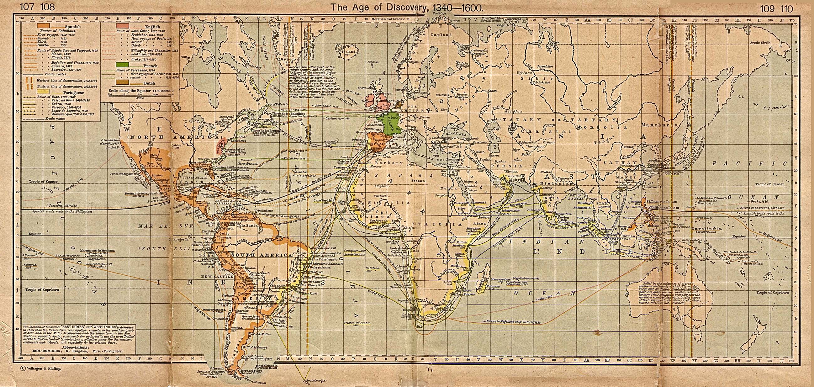
Age of Discovery 1340-1600
World map illustrating the routes and events of Spanish, Portuguese, English, French, and Dutch explorers.
www.lib.utexas.edu/maps/historical/shepherd/explorer_map_shepherd.jpg
American Revolution and Its Era
Maps and charts of North America and the West Indies, 1750-1789. From the Library of Congress.
memory.loc.gov/ammem/gmdhtml/armhtml/armhome.html
Charting the Nation: Maps of Scotland
Image collection including maps and manuscripts relating to the geography of Scotland from 1550 to 1740.
www.chartingthenation.lib.ed.ac.uk
David Rumsey Map Collection
Focuses on 18th and 19th century North and South American cartographic materials. Includes maps, atlases, globes, school geographies, and maritime charts.
www.davidrumsey.com
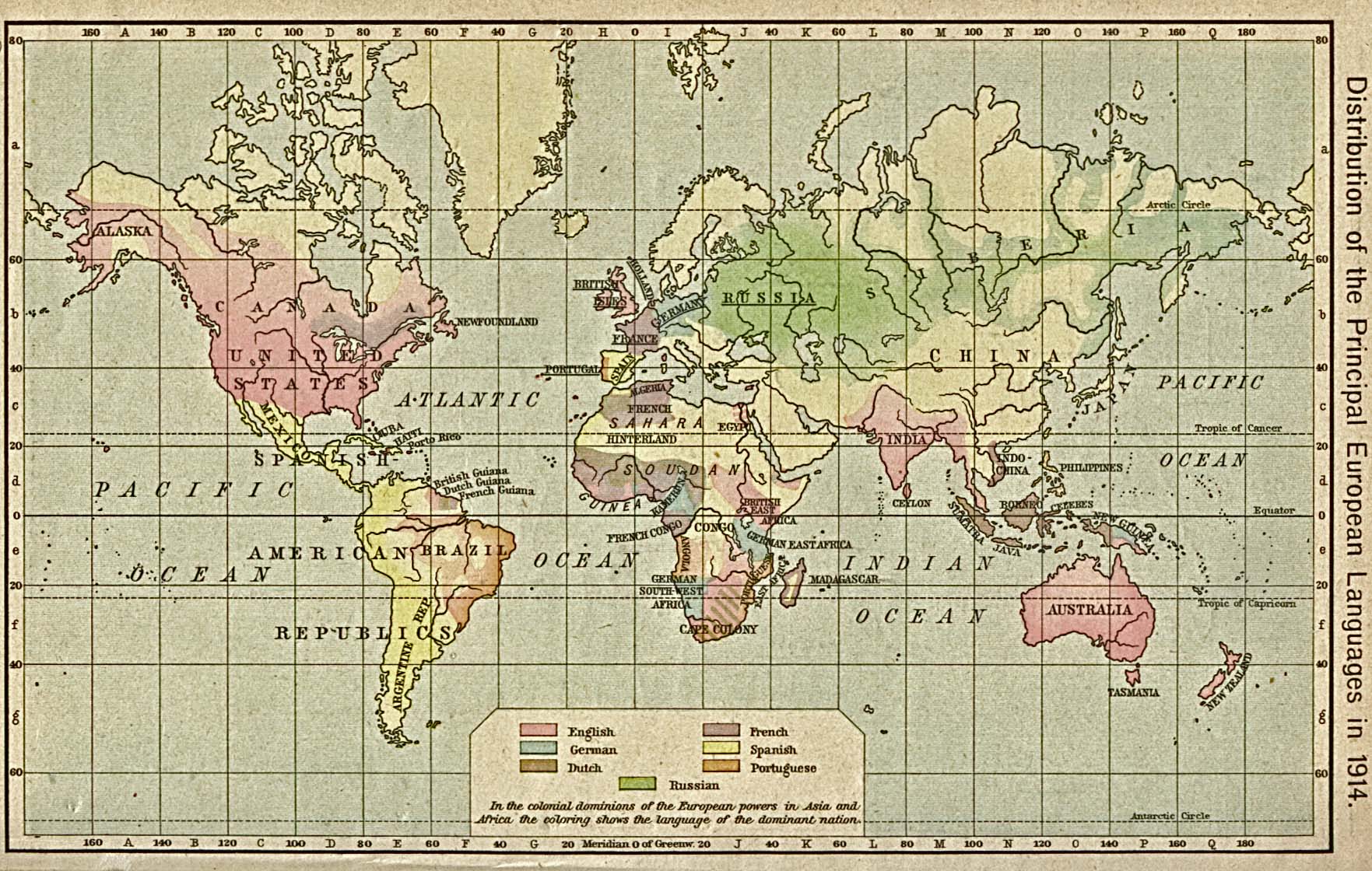
Distribution of European Languages
World map illustrating the spread of European languages, from 1914.
www.lib.utexas.edu/maps/historical/shepherd/euro_language_dist_1914.jpg
Historic Cities
Contains maps, literature, documents, books, and other materials concerning historic cities around the world.
historic-cities.huji.ac.il
Historic Map Works
Specializing in reproductions of old U.S. and international maps. Online collection has over 200,000 images. Fast growing collection of maps and directories.
www.historicmapworks.com
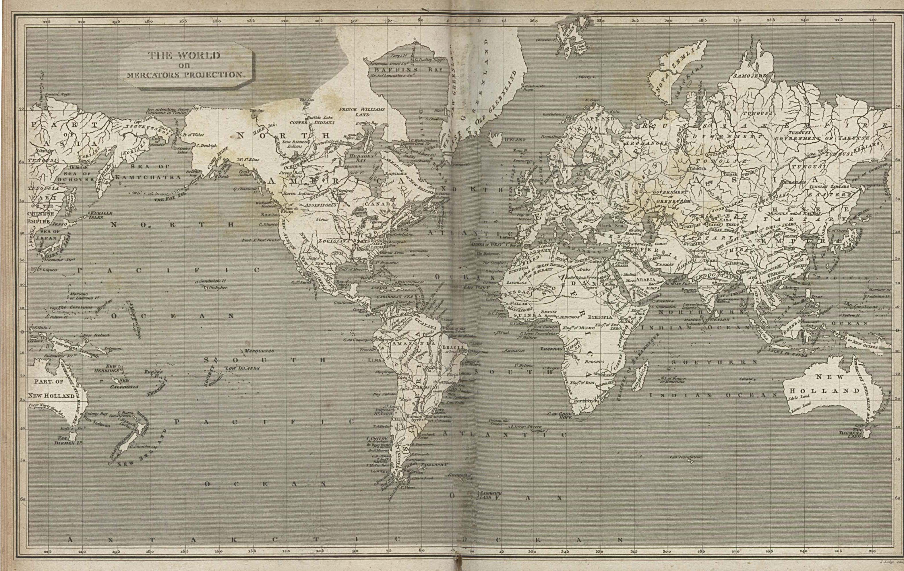
Historical Atlas by William R. Shepherd, 1923
Maps illustrating empires, eras, and events through the history of civilization.
www.lib.utexas.edu/maps/historical/history_shepherd_1923.html
Historical Atlas of Canada Online Learning Project
Uses thematic mapping to describe Canada's development.
mercator.geog.utoronto.ca/hacddp/page1.htm
Historical Atlas of Europe AD 1 to 1600
Online historical atlas showing the states of Europe and Mediterranean basin at the end of each century from AD 1 to AD 2000. In English and French.
www.euratlas.com
Historical Atlas of the Twentieth Century
Including information on socio-economic trends, systems of government, wars, and religion.
users.erols.com/mwhite28/20centry.htm
Historical Maps of Africa
Includes maps of pre-colonial Africa as well as individual colonies and expedition maps.
www.lib.utexas.edu/maps/historical/history_africa.html
Historical Maps of Asia
Includes overview maps as well as nations, principal cities, and military maps of the Asia-Pacific Theater in World War II.
www.lib.utexas.edu/maps/historical/history_asia.html
Historical Maps of Australia and the Pacific
Includes 19th-century maps plus military maps from World War II.
www.lib.utexas.edu/maps/historical/history_austral_pacific.html
Historical Maps of Europe
Directory of regional maps depicting ancient Greece through the European Theater of World War II.
www.lib.utexas.edu/maps/historical/history_europe.html
Historical Maps of the Americas
Includes historical overview maps, nations, regions, and individual cities.
www.lib.utexas.edu/maps/historical/history_americas.html
Historical Maps of the Middle East
Directory of reference maps from the ancient period through the Muslim conquest to World War II.
www.lib.utexas.edu/maps/historical/history_middle_east.html
Historical Maps Overview
Directory of historical maps, most from early 20th century historical atlases.
www.culturalresources.com/Maps.html
Interactive Nolli Map Web Site
Presents the 1748 Nolli map of Rome as a dynamic, interactive, hands-on tool.
nolli.uoregon.edu
Maps of the Pimer?a
Original, rare, and historic maps portraying a region of New Spain from the 16th to the 19th century. From the University of Arizona Library Map Collection.
dizzy.library.arizona.edu/pimeria
McMurry University: Historical Maps
Features historical maps of Texas, the United States, and Mexico. Also includes maps of the Holy Roman Empire and Sub-Saharan Africa.
www.mcm.edu/academic/depts/history/maplink.htm
Military Maps of WWII
From a variety of sources.
mapww2.narod.ru
Motco
Retailer and reference database of topographical prints, maps, prospects, and panoramas of London, the Thames, and the U.K.
www.motco.com
Nevada History in Maps
Features historic maps of the territory and state of Nevada and surrounding regions. From the the University of Nevada, Reno.
www.delamare.unr.edu/maps/digitalcollections/nvhistory/Default.htm
Panoramic Maps 1847-1929
Nonphotographic representations of cities portrayed as if viewed from above at an oblique angle, from the late nineteenth and early twentieth centuries.
lcweb2.loc.gov/ammem/pmhtml/panhome.html
Perspective in Maps: From Columbus to Lewis and Clark
www.lib.virginia.edu/exhibits/lewis_clark/home.html
Ryhiner Project
Conserving, microfilming, and cataloging more than 15,000 maps, charts, plans, and views from the 16th to the 18th century, covering the whole globe.
www.stub.unibe.ch/stub/ryhiner/ryhiner.html
 Help us improve the Yahoo! Directory - Share your ideas